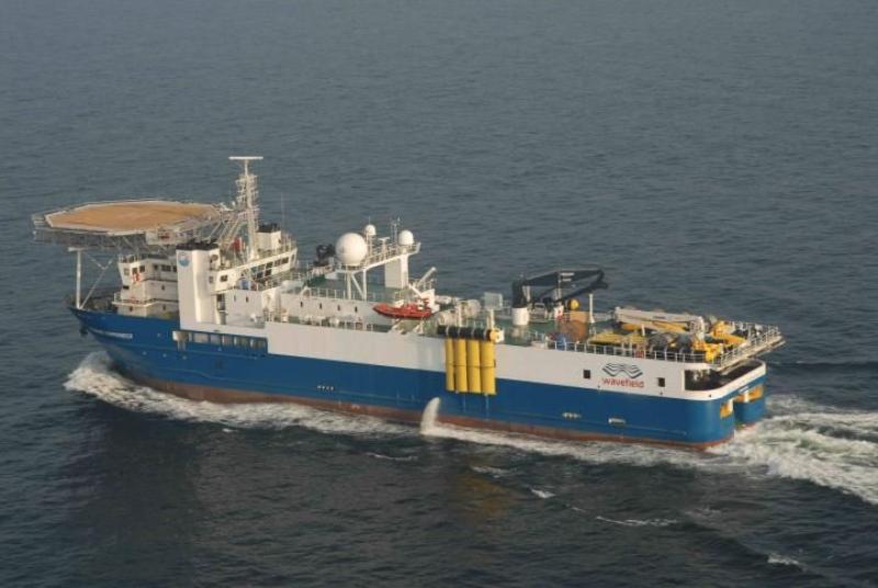
What is a Seismic Survey?
A seismic survey is a method used by geologists and geophysicists to map the subsurface structures and geology beneath the Earth's surface, especially in the search for oil and natural gas. It involves using controlled seismic source explosions or seismic vibrators on land, or air guns being fired into the water from survey vessels at sea. The energy released travels downward through rock layers and is reflected back to the surface where it is recorded by sensitive hydrophones or geophones. These receivers can detect and record the sound waves refracted and reflected by geological structures underground. The recorded data is then analyzed using complex mathematical techniques to build detailed images of what lies below.
Seismic Data Acquisition and Processing
During a land Seismic Survey, trucks with vibrator plates pound the ground at intervals along survey lines to generate low-frequency seismic waves. Geophones, which are spike-mounted receivers, record the returning vibrations. Offshore surveys use air gun arrays towed behind survey vessels to produce acoustic pulses. Hydrophone streamers extending behind the ships record the reflected signals. The raw recorded data contains noise that needs to be removed through signal processing techniques. Refraction statics, deconvolution, velocity analysis, stacking, and migration are some of the processes used to enhance reflectors and produce clearer subsurface images.
Interpreting Seismic Data
Once processed, seismic data is analyzed and interpreted to provide information about subsurface rock formations, geological structures like faults and folds, fluid content, and the potential presence of hydrocarbons. Seismologists use workstation software to visualize seismic sections as two-dimensional profiles or build three-dimensional volumetric datasets. Time or depth conversion relates the reflections to true geological depths by incorporating data on rock velocities. This interpretation aids in prospect mapping and evaluating potential drilling locations for exploration and production wells. Seismic data also allows monitoring of reservoir changes and fluid movement over time in producing fields through 4D or time-lapse seismic surveys.
Role in Oil and Gas Exploration
Seismic surveys play a vital role in the oil and gas exploration process. They provide the only means of directly imaging subsurface geology without drilling. Data acquisition and interpretation allows geoscientists to create mapping of potential reservoir formations and identify structural or stratigraphic traps that may contain accumulations of hydrocarbons. This significantly reduces exploration risk by targeting the most prospective areas for exploratory drilling. Seismic also aids in well planning, choosing optimal well paths to maximize drainage and avoid drilling hazards. In production, 4D seismic facilitates reservoir management by monitoring sweep efficiency and fluid fronts. Without high-resolution seismic data, the exploration process would essentially be blind and involve much higher risk through random wildcat drilling.
Onshore vs Offshore Seismic Techniques
While the basic principles remain the same, seismic data acquisition differs on land versus offshore due to access and environmental factors. Onshore surveys have simpler logistics as vibrator trucks or drilling explosions can generate seismic waves directly at source points. However, vegetation and cultural noise from roads/buildings pose challenges. Offshore requires specialized survey vessels to deploy air gun arrays and streamers behind the ship. This allows very large areas to be surveyed efficiently but incurs greater operational complexity and costs. Water depth also impacts equipment choices and data processing. Overall, offshore seismic provides superior subsurface imaging capability due to fewer near-surface complications.
Advantages and Limitations
Seismic surveys deliver tremendous benefits by revealing subsurface structures for hydrocarbon exploration with minimal surface disturbance. When processed and interpreted properly, the data quality and resolution have improved dramatically in recent decades. However, seismic reflections only provide indirect information and reservoirs may be missed if not properly mapped. Small deposits, complex fault zones, and certain lithology types like gas sands are difficult to image accurately. Even with high-end 3D and 4D seismic, some uncertainties remain that require calibration through exploration drilling. Integrating seismic data with other metrics like well logs, core data, and production tests provides the most robust subsurface picture to minimize exploration risk.
Role of Modern Seismic Technology
Constant advances in seismic data acquisition systems and supercomputing capabilities continue driving major improvements. Larger sensor spreads, denser source intervals, broadband recording, and full-azimuth surveying enhance subsurface illumination and resolution. Pre-stack depth imaging now routinely produces sub-seismic scale resolution through advanced wavefield separation and inversion. Massive processing power allows building very high resolution 3D/4D models directly in the depth domain. Permanent reservoir monitoring systems enable near-real time surveying. Emerging techniques utilizing seismic interferometry promise new insights by virtually deploying sources and receivers anywhere. Combined with other technologies like microseismic monitoring, modern seismic plays a central part in optimizing hydrocarbon recovery from existing fields and reducing risk in new exploration frontiers.
seismic surveys provide the oil and gas industry's primary means for reliably imaging subsurface geology without drilling. Constant innovations continue extending the capabilities for mapping complex structures and reservoirs at ever higher resolution. Integrated with other data streams in an exploration program, high quality seismic data acquisition and analysis reduces risk and guides optimum well placement decisions. Both onshore and offshore, it will remain essential for exploring new prospects and maximizing recovery from known fields for decades to come. When properly planned and interpreted, seismic surveys deliver tremendous value by illuminating hidden hydrocarbon resources beneath the Earth's surface.
